Processing...

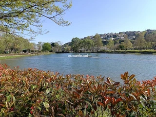
Ataturk forest farm

Coordinates 658 people viewed ID: 5719

Access Details

Bumpy road %0
Road distance 9K
Arrival time 10m
Public Transit Go by Metro
Taxi Fare
Live Weather & Visibility Telemetry
Live & Instant Update • Checked: 15:48
Horizontal Visibility
Clear & Excellent Visibility (44 km)
Current Temperature
22.3°C
Cloud Cover
27%
Wind Speed
9.3 km/h

Description

Scan QR QR code
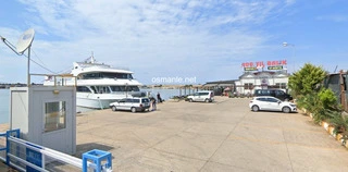
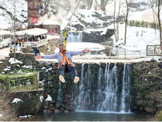
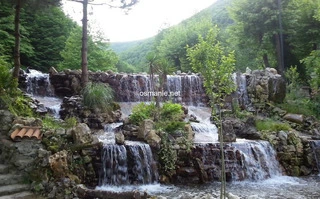
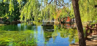
Established on land awarded to Ataturk in 1925, the farm has the leading quality of Turkish agriculture. Ataturk donated it to the Treasury in 1937. Inside, there is the largest zoo, and state cemetery, along with the historic Black Sea pool. At the entrance to the farm administration building, a clock in the form of a tower, with an area of ​​about 102 thousand hectares, was built in 1926 to match the employees working hours. It is still working today. The area with an area of ​​46 hectares and known as Gazi facilities at Ataturk Forest Farm, which was registered as a Class I site in 1922, was reorganized as a Class III Natural Site in 2011.

Location: Ankara

Get directions

Nearby places & attractions
How far is it? Places in your area Search within range km

Regions
Restaurants
Hotels
Villas
Apartments
Cars
Telecom
The calculation accuracy of the distance and estimated arrival time is approximately 90%.
💬 Was this information helpful and accurate?

Comments

No comments has been added yet
Osmanle
Osmanle
Pro
🏆 Founding Expert
📍 Added 3937 tourist places
🏆 Osmanle Experts in Turkey

Do you know tourist places or routes? Share your experiences and earn a verified expert badge.

Recently Viewed Places

Ayder
Lake Ambarley (Fish Lake)
Osmanle 🏆 Founding Expert
Lake Ambarley is a lake located at an altitude of 2,995 meters. It has four other small lakes around it, which is the last point that can be reached by car. It is the place where different sports clubs interested in natural sports trips and camping every year; It has a great view.
1.3 Thousand people viewed
%80
176K
3.32h
Aksaray
The ancient city of Mokisos
Osmanle 🏆 Founding Expert
The ancient city of Mokisos, was used as a military center in the past, and there are Roman and Byzantine ruins in particular, although the exact date of the founding of the city is not known, it is estimated that it was founded in the fourth century BC, the height of the place where the city was founded is approximately 1300-1400 meters, the city which was ...
670 people viewed
%0
27K
30m
Plan your trip & save your favorite spots Create Free Account
Copyright © 2026 osmanle.net All rights reserved.
Non-logged user
Hello wave
Welcome! Sign in or register
Planning & Discovery
Travel Services
Community & Guides
App Icon
Osmanle App
Faster & easier guide for tourism in Turkey
Install on iPhone

Tap the Share button at the bottom of Safari, then select "Add to Home Screen" ➕

🚖

Estimated Taxi Fare Calculator 🚕

Destination (Arrival Point):
...
Departing from: ...
Estimated Distance: 0 km
Estimated Time: ~ 0 mins
Estimated Taximeter Fare:
0 ₺
($ 0.00)
💡 Information: Fares are taximeter estimates based on official rates and may vary with traffic, excluding electronic bridge/highway tolls (HGS).