Processing...

Arab Douz Park and Waterfall

Coordinates 5.4 Thousand people viewed ID: 6679

Access Details

Bumpy road %40
Road distance 26K
Arrival time 45m
Taxi Fare
Live Weather & Visibility Telemetry
Live & Instant Update • Checked: 01:21
Horizontal Visibility
Clear & Excellent Visibility (25 km)
Current Temperature
22°C
Cloud Cover
10%
Wind Speed
5 km/h

Description

Scan QR QR code
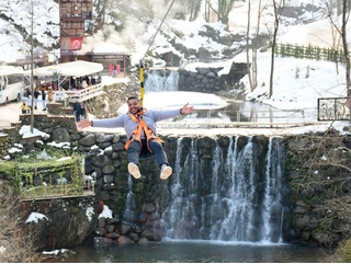
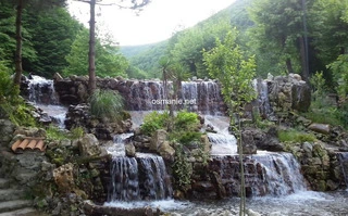
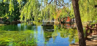
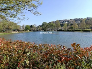
It is a natural park area that was completed and opened in 2014. It is located on an area of 106 hectares of land. It features a 1-kilometer walking path, watchtowers, suspended wooden and stone bridges, and seating and picnic areas. It is located at an altitude of 800 meters and 25 kilometers from the beach. According to locals, the region was a place where Arab caravans passed in ancient times. Designed with all visitors needs in mind, the area features a camellia, a country house, a mosque for women and men, and a Bosnian Brotherhood fountain.

Location: Rize

Get directions

Nearby places & attractions
How far is it? Places in your area Search within range km

Regions
Restaurants
Hotels
Villas
Apartments
Cars
Telecom
The calculation accuracy of the distance and estimated arrival time is approximately 90%.

💬 Was this information helpful and accurate?

Comments

No comments has been added yet
Osmanle
Osmanle
Pro
🏆 Founding Expert
📍 Added 3937 tourist places
🏆 Osmanle Experts in Turkey

Do you know tourist places or routes? Share your experiences and earn a verified expert badge.

Recently Viewed Places

Kayseri
Metro
Ruins of Kultepe (Kanesh)
Osmanle 🏆 Founding Expert
This place was used in the past as the center of the Kanish Kingdom in 2000 BC. Due to its easy connection with the surrounding settlements, it became one of the most important points in the region in terms of economy and politics. And it is learned from the sources that the name of the region in the early days was Kanesh or Nasha. These documents indicate t...
1.4 Thousand people viewed
%20
22K
31m
Manisa
Lake Soloklu
Osmanle 🏆 Founding Expert
Lake in the Jebel Spil area and the surrounding green pine forests. Camping with its reflection on the water can provide an unforgettable camping experience here. Located in the east of Mount Sabal National Park, the lake is a suitable place for camping due to its surroundings. You can camp anywhere around the lake and enjoy the peace. There are kiosks and f...
893 people viewed
%40
28K
51m
Plan your trip & save your favorite spots Create Free Account
Copyright © 2026 osmanle.net All rights reserved.
Non-logged user
Hello wave
Welcome! Sign in or register
Planning & Discovery
Travel Services
Community & Guides
App Icon
Osmanle App
Faster & easier guide for tourism in Turkey
Install on iPhone

Tap the Share button at the bottom of Safari, then select "Add to Home Screen" ➕

🚖

Estimated Taxi Fare Calculator 🚕

Destination (Arrival Point):
...
Departing from: ...
Estimated Distance: 0 km
Estimated Time: ~ 0 mins
Estimated Taximeter Fare:
0 ₺
($ 0.00)
💡 Information: Fares are taximeter estimates based on official rates and may vary with traffic, excluding electronic bridge/highway tolls (HGS).