The bridge dates back to the nineteenth century and is a three-spandrel arch bridge. Rubble stone and cut stone were used as materials for the two-eyed arch bridge. The bridge extending east-west is 35.00 meters long, 13 meters high and 2.70 meters wide. It is a historical link, the bridge is also known as the Ottoman Bridge.
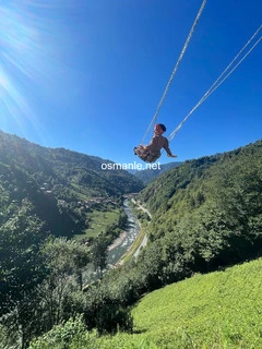
It is in the famous Camlihemsin district of Rize for its wooden houses made of pine, hornbeam and chestnut trees. Wonderful nature view, with unforgettable memories in nature with your loved ones.
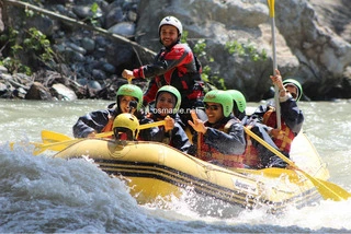
The Vertina Current was formed by the merging of streams on the slopes of the Kachkar Mountains facing the Black Sea. It is among the first places preferred by nature lovers. It is 57 kilometers long. The Vertina Stream runs through tea gardens and is decorated with arch bridges, and has paths suitable for rafting. It is suitable for river sports throughout ...
Pokot plateau is located at an altitude of 2020. A very popular plateau in terms of tourism for its unspoilt nature and stunning scenery. It is estimated that the first settlement on the Pokot plateau, which means valley of winds in Armenian, occurred about 200 years ago. Pokot Plateau, one of the most beautiful Ayder plateaus, gets filled with local and for...
Avosur Plateau, one of the newly discovered Ayder Plateau, the plateau used by seven Latzian villages, is located 2,350 meters above sea level. It consists of 40-50 families on average, of wooden and stone houses, all of which are built on low plan due to the danger of dew. The plateaus here, surrounded by high mountains, produce their own electricity throug...
Lake Ambarley is a lake located at an altitude of 2,995 meters. It has four other small lakes around it, which is the last point that can be reached by car. It is the place where different sports clubs interested in natural sports trips and camping every year; It has a great view.
The live village of Chana attracts the attention of campers and those who want to spend time in nature. You can do everything naturally, such as gathering firewood, carrying water, making a fire, and digging holes for toilet needs, in the most natural way. It is possible to take part in various tours to see and explore the natural beauty of Findikli and its ...
The Golasina plateau is located 2,230 meters above sea level. The Golasina plateau, with a mysterious appearance with its original and local homes, houses an average of 100 families. It hosts colorful plateau festivals every summer.
Qalar Plain, it is one of the flat areas, it is a quieter spot compared to the Ayder plateau, you reach the Qalar Plain in about half an hour from the Ayder plateau, you can also enjoy the wonderful views on the road. There are very suitable areas for camping. The area, at 1,600 meters, is very cold in almost every season.
The Vertina River, one of the symbols of Ayder and even the Black Sea, is a mythical stream that has been the subject of films. One of the largest rivers in the eastern Black Sea basin, with an area of 1177.03 km2, is approximately 58 km long. It flows into the Black Sea, as a stream consisting of a mixture of streams flowing from the slopes of the Kachkar M...
Ibala Castle as one of the historical places and structures. It is estimated that the castle, which resembles Castle Zell in terms of structure and construction and means high as a name, was built in the same period, that is, between the fourteenth and fifteenth centuries. It is referred to in some sources as Pharos Castle. The castle is located on steep slo...
Chenyova Bridge is a historic arched bridge built in 1696. Built with one eye according to the geography of the Black Sea, it is 40 meters long and 20 meters high. It is one of the famous buildings amongst local and foreign tourists today. In the middle of the picturesque nature.
The brides dress cascade, so named because of its white water flowing like tulle and veil. It is a natural wonder that dazzles those who see it with its wonderful sight. With a steep flow of 1500 meters, only the last part of the waterfall, which is located at an altitude of 1320 meters, can be seen due to dense fog. The highest waterfall in Turkey has the d...
The Chat Valley, one of the most precious beauty, is a heaven-like valley with its rich vegetation, endemic flower species, fruit trees, rhododendron (kumar) trees, spruce trees and trumpet trees. Due to these features, the valley meticulously protected by the locals, is a destination that attracts great interest from tourists today. The village is decorated...
The waterfall, which can be reached on foot from a one kilometer long road and empties from a height of 35 meters, where there are other waterfalls near it, as a natural park named Akyamach Falls. An area of 50 hectares of land has been prepared, a one-kilometer road has been built up to the waterfall. A visitor restaurant is built near the waterfall, which ...
The Cabahur Plateau, also known as Plateau Lake, is located in the Cabahur Valley, since the Cabahur Valley covers an area of 10 km, there are small plateaus on which neighboring villages practice their livestock and relocation activities. Most of the houses on the plateau consist of small log houses built from logs. However, the use of concrete in newly bui...
Iserlik Nature Park is one of the places that Rize residents prefer for their daily outings. The natural park, which is located at an altitude of 700 meters and combines a view of Rize with a unique view of the Black Sea, welcomes many visitors throughout the year. It is possible to camp in suitable places and enjoy nature in the natural park. The park has a...
The park comprises an area of 51 thousand 550 hectares. It was declared a national park in 1994, and it is also featured as one of 200 environmental hotspots that must be protected by the WWF. Kachkar Mountains National Park, which has the largest share of tourism in Rize, is visited by thousands of local and foreign tourists every year. Mountains with a v...
It is a natural park area that was completed and opened in 2014. It is located on an area of 106 hectares of land. It features a 1-kilometer walking path, watchtowers, suspended wooden and stone bridges, and seating and picnic areas. It is located at an altitude of 800 meters and 25 kilometers from the beach. According to locals, the region was a place where...
Photos of the house and the famous countryside bridge in Ikizider. The view of the wooden bridge towards the mosque, the river, the green mountains and nature is very beautiful for photographing.
The Anzer plateau is famous for its colorful flowers and medicinal honey, located at an altitude of 2105 meters, where endemic flowers grow more than the total flowers in Europe, it is also famous for its icy waters and clean air. The best time to visit Anzer Plateau is between May and June. The plateau also offers accommodation, food and drink opportunities...
Piliki cave, is an artificial cave created by man to extract folded raw materials used in cooking hamsiculi (anchovy bread) and corn bread, BC The process that began in 2300 by local people continued until the 1970s to remove the stacked stone. The cave consists of many tunnels. In addition, there are many ponds and wells in the cave.
The waterfall, which is almost a hidden paradise, is named after the Agaran waterfall because it flows from a steep and high rock through a scattering of snow-white foam. Agaran waterfall, which comes before you with stunning landscapes in a forest containing every shade of green, is one of the most popular paths for tourists in recent times. You can enter t...