Processing...

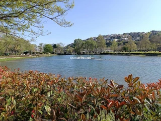
Montenegro urban forest

Coordinates 1.2 Thousand people viewed ID: 5112

Access Details

Bumpy road %0
Road distance 3.7K
Arrival time 8m
Taxi Fare
Live Weather & Visibility Telemetry
Live & Instant Update • Checked: 06:56
Horizontal Visibility
Clear & Excellent Visibility (40 km)
Current Temperature
15.6°C
Cloud Cover
68%
Wind Speed
7.6 km/h

Description

Scan QR QR code
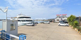
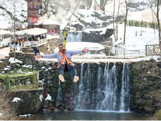
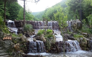
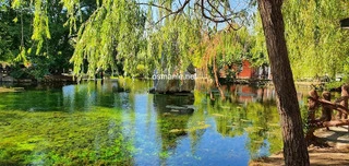
The urban forest of Montenegro, spread over a large area of 57 hectares. The forest, located on a high hill, has been arranged as a day park and picnic area by the General Directorate of National Parks, in the area there are seating groups such as camellias, benches, picnic tables, walking paths, childrens playgrounds and bicycle paths. Generally preferred by families with children for weekend activities, quite ideal for those who like to be in contact with nature.

Location: Adiyaman

Get directions

Nearby places & attractions
How far is it? Places in your area Search within range km

Regions
Restaurants
Hotels
Villas
Apartments
Cars
Telecom
The calculation accuracy of the distance and estimated arrival time is approximately 90%.
💬 Was this information helpful and accurate?

Comments

No comments has been added yet
Osmanle
Osmanle
Pro
🏆 Founding Expert
📍 Added 3937 tourist places
🏆 Osmanle Experts in Turkey

Do you know tourist places or routes? Share your experiences and earn a verified expert badge.

Recently Viewed Places

Sinop
Yesil Mavi Meat Restaurant
Osmanle 🏆 Founding Expert
It is basically a large facility with a beach, a forest camp and a wedding venue, those who wish can have breakfast with a view of the sea, those who wish can have breakfast in the nature equipped with lush trees, the restaurant offers lunch, dinner and barbecue services.
728 people viewed
%0
0
0
Marmaris
Marmaris May 19 - Youth Mediator
Osmanle 🏆 Founding Expert
Marmaris Youth Park 19 May is a symbol of Marmaris and one of the most popular areas of activity. Although different activities are organized every month, many different events and shows take place in the evenings, especially in the summer season, and the publics participation in these events is guaranteed.
855 people viewed
%0
110M
1m
Duzce
Akcha Koga Yellow Yaila Dam
Osmanle 🏆 Founding Expert
The pond area, formed by the water of the dam, resembles lush and dense pine forests with their saturated green hues. The area is suitable for hiking and camping. Honestly, we can say that this place has not been discovered much. You can see that some residents of Sariyela Village are beekeepers here.

1.3 Thousand people viewed
%20
52K
1.05h
Kahramanmaras
Kahramanmaras Castle
Osmanle 🏆 Founding Expert
Kahramanmaraş Castle is built on a high, pointed hill in the south and a slightly sloping hill in the north. It is believed that it was built between the first century BC and the second century AD, when many historical artifacts belonging to the period of the young Hittites appeared, and as a result of these excavations carried out in the castle; The four li...

1.2 Thousand people viewed
%0
2.3K
7m
Plan your trip & save your favorite spots Create Free Account
Copyright © 2026 osmanle.net All rights reserved.
Non-logged user
Hello wave
Welcome! Sign in or register
Planning & Discovery
Travel Services
Community & Guides
App Icon
Osmanle App
Faster & easier guide for tourism in Turkey
Install on iPhone

Tap the Share button at the bottom of Safari, then select "Add to Home Screen" ➕

🚖

Estimated Taxi Fare Calculator 🚕

Destination (Arrival Point):
...
Departing from: ...
Estimated Distance: 0 km
Estimated Time: ~ 0 mins
Estimated Taximeter Fare:
0 ₺
($ 0.00)
💡 Information: Fares are taximeter estimates based on official rates and may vary with traffic, excluding electronic bridge/highway tolls (HGS).