Processing...

Tokale Canyon

Coordinates 730 people viewed ID: 4375

Access Details

Bumpy road %40
Road distance 164K
Arrival time 2.45h
Taxi Fare
Live Weather & Visibility Telemetry
Live & Instant Update • Checked: 22:54
Horizontal Visibility
Clear & Excellent Visibility (25 km)
Current Temperature
22°C
Cloud Cover
10%
Wind Speed
5 km/h

Description

Scan QR QR code
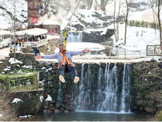
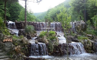
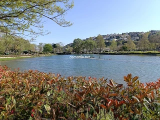
Spreading over an area of 20 km, it is one of the deepest and challenging valleys in Turkey, full of adventures and adrenaline junkies. It walks in some parts of the valley, in some parts climbing, and sometimes in the cold water. It will not be easy to go further down the valley when you come here, you have to have all the materials that you will need with you, because crossing the valley can take around 8 hours. When you get closer to the entrance to the canyon, you will see rock rocks and eagle nests. You will spend an adventurous day with a wonderful view and be able to see Lake Işık and the Gümüşsu region as you climb from the riverbed.

Location: Denizli

Get directions

Nearby places & attractions
How far is it? Places in your area Search within range km

Regions
Restaurants
Hotels
Villas
Apartments
Cars
Telecom
The calculation accuracy of the distance and estimated arrival time is approximately 90%.
💬 Was this information helpful and accurate?

Comments

No comments has been added yet
Osmanle
Osmanle
Pro
🏆 Founding Expert
📍 Added 3937 tourist places
🏆 Osmanle Experts in Turkey

Do you know tourist places or routes? Share your experiences and earn a verified expert badge.

Recently Viewed Places

Gümüşhane
Lake Limni Zigana
Osmanle 🏆 Founding Expert
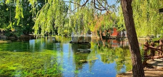
Lake Limni is one of the most important natural beauties in the region. A stroll around the lake in the lush nature park gives you peace of mind. There is a facility within the Natural Park to cater to the visitors needs. Almost all kinds of needs can be easily catered for from points like toilet, parking, drinking fountains, bungalows, country restaurant an...
843 people viewed
%20
40K
50m
Bartin
Ferry Restaurant
Osmanle 🏆 Founding Expert
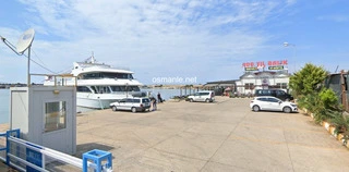
It attracts visitors with its location and view. It is located close to the beach and, as its name suggests inside the ferry, enchants visitors with grilled fish, seafood, hot appetizers and mixed breakfast menus.
685 people viewed
%0
0
0
Uzungol
Sultan Murad Heights
Osmanle 🏆 Founding Expert
The plateau rises 2,200 meters above sea level. The name of the plateau began to be known as the Sultan Murad Plateau in 1635 AD, since Sultan Murad built this plateau with his army during his return from the Iran campaign. It also has trenches and tombs of martyrs from the First World War. Al Hadaba has everything you need like electricity, water, hotel, re...
6.2 Thousand people viewed
%40
38K
1h
Sakarya
Tokale Canyon
Osmanle 🏆 Founding Expert
Ma'shouqia waterfalls, more than 20 waterfalls, flow from Mount Kartepe, and the views are wonderful in the atmosphere of this picturesque place. There is a large group of wonderful restaurants and hotels, and most services are available.
193.1 Thousand people viewed
%10
32K
41m
Plan your trip & save your favorite spots Create Free Account
Copyright © 2026 osmanle.net All rights reserved.

Non-logged user
Hello wave
Welcome! Sign in or register
Planning & Discovery
Travel Services
Community & Guides
App Icon
Osmanle App
Faster & easier guide for tourism in Turkey
Install on iPhone

Tap the Share button at the bottom of Safari, then select "Add to Home Screen" ➕

🚖

Estimated Taxi Fare Calculator 🚕

Destination (Arrival Point):
...
Departing from: ...
Estimated Distance: 0 km
Estimated Time: ~ 0 mins
Estimated Taximeter Fare:
0 ₺
($ 0.00)
💡 Information: Fares are taximeter estimates based on official rates and may vary with traffic, excluding electronic bridge/highway tolls (HGS).