Processing...

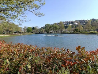
Lake Nimrud

Coordinates 844 people viewed ID: 5366

Access Details

Bumpy road %0
Road distance 38K
Arrival time 53m
Taxi Fare
Live Weather & Visibility Telemetry
Live & Instant Update • Checked: 18:57
Horizontal Visibility
Clear & Excellent Visibility (25 km)
Current Temperature
22°C
Cloud Cover
10%
Wind Speed
5 km/h

Description

Scan QR QR code
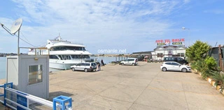
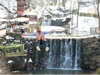
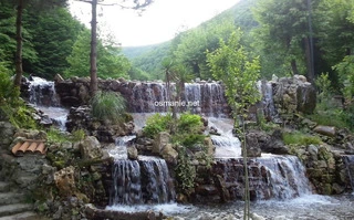
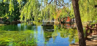
The lake is one of the most beautiful lakes in the eastern Anatolia region, and it derives its name from the name of Nimrud, the Babylonian ruler who ruled the region in 2100 BC. And hot, you can visit many points from the steam chimney around the lake to the ice cave, because this is a volcanic land, the soil is very fertile, thats why the plant diversity is also very intense in the area, when you walk around the lake, you look at the lush landscape in summer And spring, while in winter be dazzled by the unique view under the white snow.

Location: Bitlis

Get directions

Nearby places & attractions
How far is it? Places in your area Search within range km

Regions
Restaurants
Hotels
Villas
Apartments
Cars
Telecom
The calculation accuracy of the distance and estimated arrival time is approximately 90%.
💬 Was this information helpful and accurate?

Comments

No comments has been added yet
Osmanle
Osmanle
Pro
🏆 Founding Expert
📍 Added 3937 tourist places
🏆 Osmanle Experts in Turkey

Do you know tourist places or routes? Share your experiences and earn a verified expert badge.

Recently Viewed Places

Denizli
Rooster denizli
Osmanle 🏆 Founding Expert
It is a large statue in the form of a rooster, and the most famous thing about it is that it has black kohl eyes in addition to that its feet contain wonderful gray and blue colors, and its size is large for us and is considered one of the most beautiful landmarks that visitors visit to take pictures next to it.
807 people viewed
%0
2K
6m
Kastamonu
Vala Valley
Osmanle 🏆 Founding Expert
Fala Canyon is the most difficult valley to cross in Turkey by length. It has a wild structure and stands out as being its most distinctive feature. Among the steep cliffs live eagle, falcon and some wild animals. The valley, which stretches for 10 kilometers, has high rocky slopes ranging from 800-1200 meters.
1.3 Thousand people viewed
%50
117K
2.05h
Duzce
Duzge
Osmanle 🏆 Founding Expert
The city is characterized by its indescribable beauty, including plains, green farms, and hills; And mountains covered with old green trees and rivers that penetrate its center, in addition to the seas surrounding it on every side, and the city is famous for many animals and migratory birds, and rare plants that date back to nearly six hundred years. The cit...
1.7 Thousand people viewed
%0
0
0
Kocaeli
Metro
Inonu plateau
Osmanle 🏆 Founding Expert
Located at an altitude of 1050 meters, the Inonu Plateau covers an area of 500 meters. Around the plateau it is possible to observe home structures scattered. You can take a tour by starting to walk across the plateau as the people who migrated from the Black Sea reside here. It is one of the indispensable points for both campers and nature lovers. It is loc...
1.1 Thousand people viewed
%50
37K
1.06h
Plan your trip & save your favorite spots Create Free Account
Copyright © 2026 osmanle.net All rights reserved.
Non-logged user
Hello wave
Welcome! Sign in or register
Planning & Discovery
Travel Services
Community & Guides
App Icon
Osmanle App
Faster & easier guide for tourism in Turkey
Install on iPhone

Tap the Share button at the bottom of Safari, then select "Add to Home Screen" ➕

🚖

Estimated Taxi Fare Calculator 🚕

Destination (Arrival Point):
...
Departing from: ...
Estimated Distance: 0 km
Estimated Time: ~ 0 mins
Estimated Taximeter Fare:
0 ₺
($ 0.00)
💡 Information: Fares are taximeter estimates based on official rates and may vary with traffic, excluding electronic bridge/highway tolls (HGS).